Geocomputation · GeoAI · Complexity Science · Quantum Computing
Using spatial analysis, complex systems modelling, GIScience and GeoAI to understand regional dynamics, cities, resilience and the Anthropocene.
Research Areas
Cellular automata, Markov chains and agent-based models for simulating urban and land-use change at regional scale.
→
Spatial statistics, GIScience and spatial econometrics — autocorrelation, gravity models and landscape metrics.
→
Machine learning, self-organising maps and spatial regressions for prediction, pattern recognition and decision support.
→
Emergence, networks, spatial equilibria and adaptive behaviour in regional and urban systems.
→Emerging Frontier
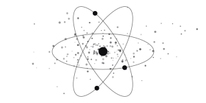
Quantum machine learning and quantum-enhanced spatial econometrics for optimisation and environmental modelling.
→Selected Work
View all publications →
2024
2013
2026
2021
2021

2026
People
Principal Investigator
Full Professor, Department of Geography & Environmental Studies, Toronto Metropolitan University
PhD Student
Environmental Applied Science & Management, Toronto Metropolitan University
Studies migration, demographics and settlement across North America and India — how climate, environmental and socioeconomic conditions shape human mobility over space and time — using GIS, spatial analysis, machine learning and quantitative methods.
PhD Student
Environmental Applied Science & Management, Toronto Metropolitan University
Studies how urban environments and transportation infrastructure shape cycling safety, using spatial analysis and predictive modelling that accounts for how those relationships vary across spaces and communities — with a parallel interest in equity of access to safe infrastructure and in data representativeness, aimed at evidence for policy and tools for safer, better-informed travel choices.
The Lab
The lab studies how spatial systems change — how cities grow, how regions diverge, how habitats shift — by treating them as complex adaptive systems rather than static maps. The guiding question is not only where patterns are, but how they would respond if costs, rules or incentives changed.
Methodologically the work combines geocomputation — cellular automata, agent-based and Markov models — with spatial statistics and econometrics, machine learning and self-organising maps, and a growing line in quantum approaches to spatial optimisation. Models are built to be reproducible and aimed at real regional problems.
Empirically the research spans European regional innovation, Canadian urban and northern systems, wetland and land-use change, urban health and injury, and heritage landscapes — a record of more than 90 peer-reviewed articles and seven Springer volumes.
News
Contact
Jorgenson Hall, JOR-620
Department of Geography & Environmental Studies
380 Victoria Street, Toronto, ON M5B 2K3